![]()
![]()

Field campaign for validation of remote sensing products, January 2009
In January 2009 DLR realized a field campaign for the collection of GPS data with the intention to validate land cover and water mask products, that were recently derived from satellite data with automatic processors. To improve the results of such products derived from remote sensing data and to know about their accuracy ground truth data are essential.
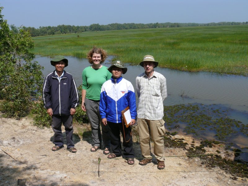
Figure 1 - Two scientists from GIRS-VAST and and from DLR in Tram Chim National Park.
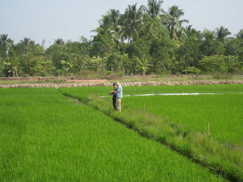
Figure 2 - Taking GPS points in the rice field.
In cooperation with two Vietnamese colleagues from GIRS-VAST two scientists from DLR (Fig.1 and 2) took GPS data in Can Tho province as well as in Tam Nong district, to cover two test sites with ground truth information on land cover classes. Depending on cost-benefit ratio planning included travelling by car along the main roads and to go further into selected subtestsites by motorbike or bicycle. The preparation of the field trip included a detailed and intensive extension of the WISDOM classification scheme with the help of Pham Bach Viet (GIRS-VAST) during his stay at DLR in November 2008. With this basic information on how many classes are expected to occur in the focussed testsites a field route was planned. The theoretical objective of field data acqusition as can be found in the literature is to cover the area with well-distributed field samples which are well-distributed proportionally to the appearance in the classes. The statistical distribution of the samples is quite satisfying (Fig.3) and mirror the classes occuring in the area. Furthermore the focus was on classes which could not be separated easily in the classification such as rural settlement and urban settlement and the different vegetation types beside rice paddies. The WISDOM classification scheme is also adapted to the conditions in the field, because some new classes are occuring which were not considered sufficiently while planning.
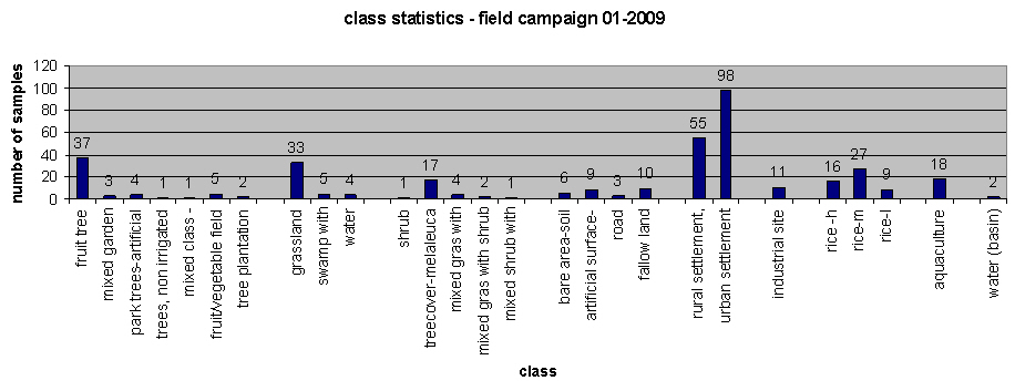
Figure 3 - statistical distribution of the 384 land cover/land use sample points.
Finally, accuracy assessment will be performed with these validation data to further improve land cover classification results. The sample points are held in a ground truth data base.
Another goal of the field campaign was the collection of sample points close to the water front of canals and the Mekong main river branch at the same time TerraSAR-X radar satellite was overpassing to validate and analyze the results of watermask generation from these radar satellite images. As the water land transition zone, i.e. few meters in shallow water towards land and the coastal stripe close to the river show some uncertainties in the validation results generated with validation data taken from satellite images so far (Gebhardt et al. 2008, 3rd TSX Science Meeting) the results from the analysis of the ground truth data are expected to improve the results.