![]()
![]()

Population density in districts, 2004
The title of this map is “Vietnam – Mekong Delta –Population density in districts, 2004”.
It depicts the distribution of population in the District units of the Mekong Delta. The legend on the right side of the map describes important map attributes, such as the class ranges, the data source, and additional map information. As the data source of this map, LandScan 2004 Global Population database of the Oak Ridge National Laboratory and administrative areas from the Vietnamese Sub-National Institute for Agricultural Planning and Projection (Sub-NIAPP), were employed.
Method: LandScan gridded data from 2004 and administrative areas of the Mekong Delta have been combined. Each of the districts was spatially intersected with the LandScan data. All the grid elements covered by the respective District polygon were summed up by their population value yielding the total number of people in the district. The LandScan Global Population Project is a worldwide population database at 30" X 30" resolution for estimating ambient populations at risk. Best available census counts are distributed to cells based on probability coefficients which, in turn, are based on road proximity, slope, land cover, and night time lights. The data used in this map originate from the LandScan 2004 Global Population Database and have been clipped to the Mekong Deltas geographic extent. For more information about the LandScan project, the official project website available at http://www.ornl.gov/sci/landscan/landscanCommon/landscan_doc.html can be referred to.
This map was created by DLR for the WISDOM project. For more information please contact Dr. Claudia Kuenzer (claudia.kuenzer@dlr.de), project coordinator on the German side. – June 2008
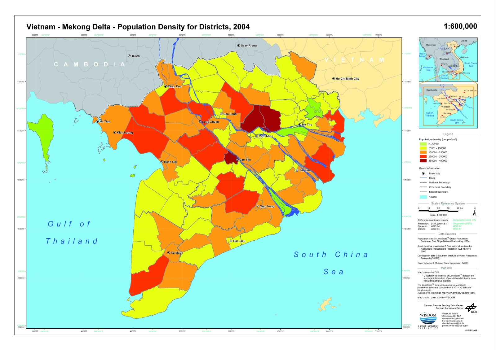
Figure 1 - Population Density for districts, 2004