![]()
![]()

Population density in the Mekong Delta, 2004
The title of this map is “Vietnam – Mekong Delta –Population density, 2004”.
It depicts the distribution of population in the Mekong Delta. The legend on the right side of the map describes important map attributes, such as the class names, scaling factor, two quicklook images of the data source and additional map information. As the data source of this map, LandScan 2004 Global Population database of the Oak Ridge National Laboratory, was employed.
Method: The LandScan Global Population Project is a worldwide population database at 30" X 30" resolution for estimating ambient populations at risk. Best available census counts are distributed to cells based on probability coefficients which, in turn, are based on road proximity, slope, land cover, and nighttime lights. The data used in this map originate from the LandScan 2004 Global Population Database and have been clipped to the Mekong Deltas geographic extent. For more information about the LandScan project, the official project website available at http://www.ornl.gov/sci/landscan/landscanCommon/landscan_doc.html can be referred to.
As additional information, the borders of the three test sites of the WISDOM project (displayed in red), namely Tam Nong district, Tra Cu district and Can Tho province and the names of their administrative centres as well as other administrative borders such as national boundaries, are included in the map.
This map was created by DLR for the WISDOM project. For more information please contact Dr. Claudia Kuenzer (claudia.kuenzer@dlr.de), project coordinator on the German side. – June 2008
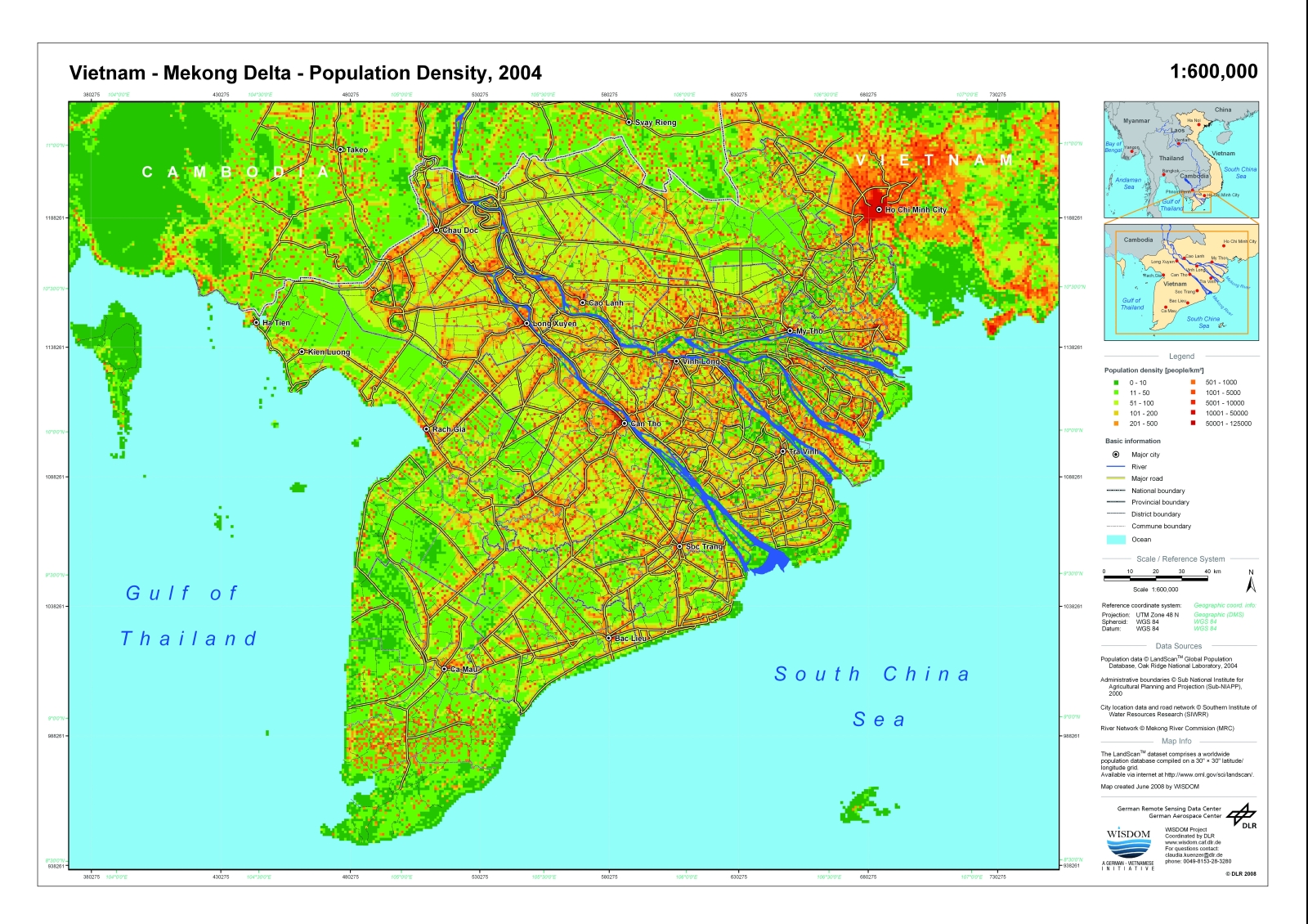
Figure 1 - Population Density in the Mekong Delta, 2004